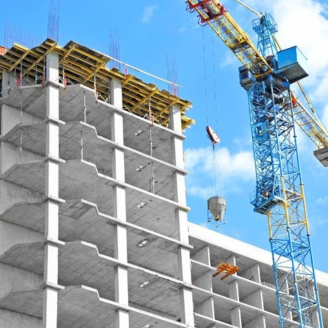
1. Importance of Geotechnical Investigation
Geotechnical investigation is a critical component in various engineering and construction projects, as it provides essential information about the subsurface conditions of a site. Here are several reasons highlighting the importance of geotechnical investigation:
Foundation Design: Geotechnical investigations help engineers determine the type of foundation that is suitable for a particular site. The soil’s bearing capacity, settlement characteristics, and other geotechnical properties are essential in designing stable and long-lasting foundations for buildings, bridges, and other structures.
Risk Assessment: Geotechnical investigations assess potential risks associated with ground conditions. This includes identifying the presence of unstable soils, underground water, seismic hazards, and other geological factors that could impact the safety and stability of a project.
Cost Estimation: Understanding the geotechnical conditions of a site allows for more accurate cost estimation. This includes determining the amount of earthwork required, selecting appropriate construction materials, and predicting potential construction delays due to adverse ground conditions.
Environmental Considerations: Geotechnical investigations also consider the environmental impact of construction projects. Assessing soil contamination, groundwater quality, and other environmental factors ensures compliance with regulations and helps develop appropriate mitigation strategies.
Infrastructure Development: Geotechnical investigations are crucial for the design and construction of infrastructure such as roads, tunnels, dams, and airports. These investigations provide data to optimize design, minimize maintenance costs, and ensure the longevity and safety of the infrastructure.
Site Selection: When choosing a site for a construction project, geotechnical investigations play a pivotal role. The suitability of a location can be determined based on soil and geological conditions, which can impact the feasibility and cost-effectiveness of a project.
Construction Safety: Knowledge of the subsurface conditions is essential for ensuring construction worker safety. Hazardous ground conditions, such as unstable soils or underground utilities, can pose risks during excavation and construction.
Regulatory Compliance: Many local and national regulations require geotechnical investigations as part of the permitting process. Compliance with these regulations is essential to obtaining the necessary approvals for construction projects.
Long-Term Performance: Geotechnical investigations provide insights into how a structure will perform over time. This is crucial for ensuring the longevity and safety of infrastructure, as well as preventing costly repairs or failures in the future.
Minimizing Litigation: Accurate geotechnical investigations can help minimize disputes and litigation between project stakeholders. When all parties have a clear understanding of subsurface conditions and potential risks, it reduces the likelihood of legal conflicts.
In summary, geotechnical investigation is a fundamental step in the planning and execution of construction and engineering projects. It helps mitigate risks, ensure safety, optimize design, and contribute to the overall success and sustainability of these projects.
2. Importance of Groundwater Management
Groundwater management is essential in geotechnical engineering for several reasons:
Soil Stability: Groundwater levels impact soil saturation and strength, which are crucial for foundation and slope stability.
Foundation Design: Proper groundwater control determines the type of foundation needed for a structure.
Excavation Safety: Managing groundwater prevents flooding during excavation and maintains safe working conditions.
Infrastructure Integrity: It protects underground utilities from corrosion and maintains their structural integrity.
Risk Reduction: Effective management minimizes construction delays, accidents, and structural failures related to groundwater issues.
In geotechnical engineering, groundwater management is fundamental to ensuring project safety and stability.

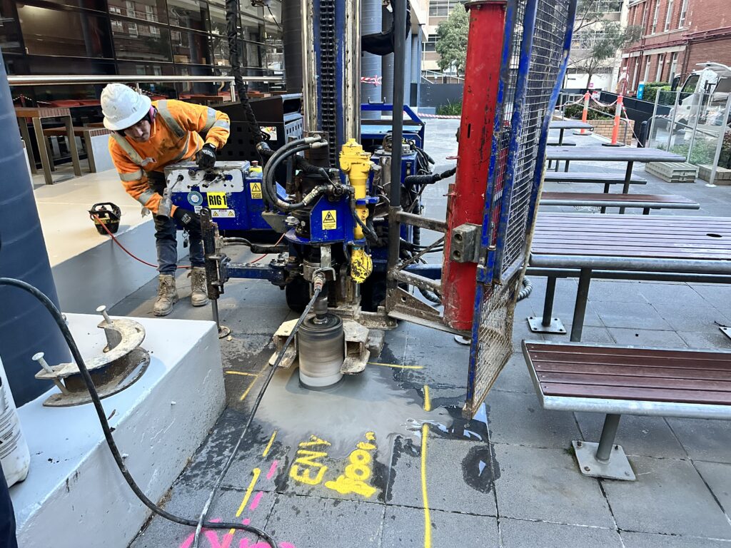
3. Soil Contamination and its Importance
- It can affect the stability of foundations. Contaminated soil can have different properties than clean soil, such as lower strength or higher compressibility. This can make it more difficult to design foundations that are safe and stable.
- It can increase the risk of erosion. Contaminated soil can be more easily eroded than clean soil. This can lead to problems such as landslides and flooding.
- It can reduce the bearing capacity of soil. The bearing capacity of soil is the maximum load that it can support without collapsing. Contaminated soil can have a lower bearing capacity than clean soil, which can make it difficult to design safe and stable structures.
- It can affect the durability of structures. Contaminated soil can corrode the foundations and other components of structures. This can shorten the lifespan of structures and make them more expensive to maintain.
- It can contaminate groundwater. Contaminants in soil can leach into groundwater, which can contaminate drinking water and other water supplies.
- Geotechnical and structural engineers need to be aware of the potential risks of soil contamination when designing and constructing structures. They need to take steps to prevent soil contamination and mitigate the risks of soil contamination if it does occur.
Here are some of the things that geotechnical and structural engineers can do to address soil contamination:
- Conduct soil tests to determine the presence and extent of contamination.
- Design foundations and other structures that are safe and stable in contaminated soil.
- Use materials that are resistant to corrosion in contaminated soil.
- Install groundwater monitoring systems to detect and prevent the spread of contamination.
- Cleanup contaminated soil if necessary.
4. Soil Contamination and its Contribution
Soil contamination is the presence of harmful substances in the soil that can have a negative impact on human health, the environment, and the productivity of the soil. These harmful substances can come from a variety of sources, including industrial activity, agricultural practices, and urban runoff.
Here are some of the things that geotechnical and structural engineers can do to address soil contamination:
- Reduced crop yields and quality. Contaminated soil can reduce crop yields by making it difficult for plants to grow. Contaminated soil can also make crops more susceptible to pests and diseases. Contaminated soil can also make crops less nutritious.
- Contaminated food and water. Contaminants in soil can leach into groundwater, which can contaminate drinking water and other water supplies. Contaminants in soil can also be absorbed by plants, which can then be consumed by humans and animals.
- Harm to human health. Exposure to harmful substances in contaminated soil can cause a variety of health problems, including cancer, reproductive problems, and neurological disorders.
- Disruption of ecosystems. Contaminated soil can harm plants and animals. It can also disrupt the natural cycling of nutrients in the soil.
- Increased risk of flooding and erosion. Contaminated soil can be more easily eroded than clean soil. This can lead to problems such as landslides and flooding.
- Soil contamination is a serious problem that can have far-reaching consequences. It is important to take steps to prevent soil contamination and to clean up contaminated soil when it does occur.
- Using safe agricultural practices
- Reducing the use of pesticides and fertilizers
- Properly disposing of hazardous waste
- Regulating industrial activities
- If soil contamination does occur, it is important to clean it up as soon as possible. There are a number of methods that can be used to clean up contaminated soil, including:
- Excavation and removal of contaminated soil
- Treatment of contaminated soil in place
Here are some of the ways to contribute to the prevention of soil contamination:
- Educate yourself about the causes and effects of soil contamination.
- Support policies that promote the prevention of soil contamination.
- Use safe and sustainable agricultural practices.
- Dispose of hazardous waste properly.
- Report any suspected soil contamination to the authorities.
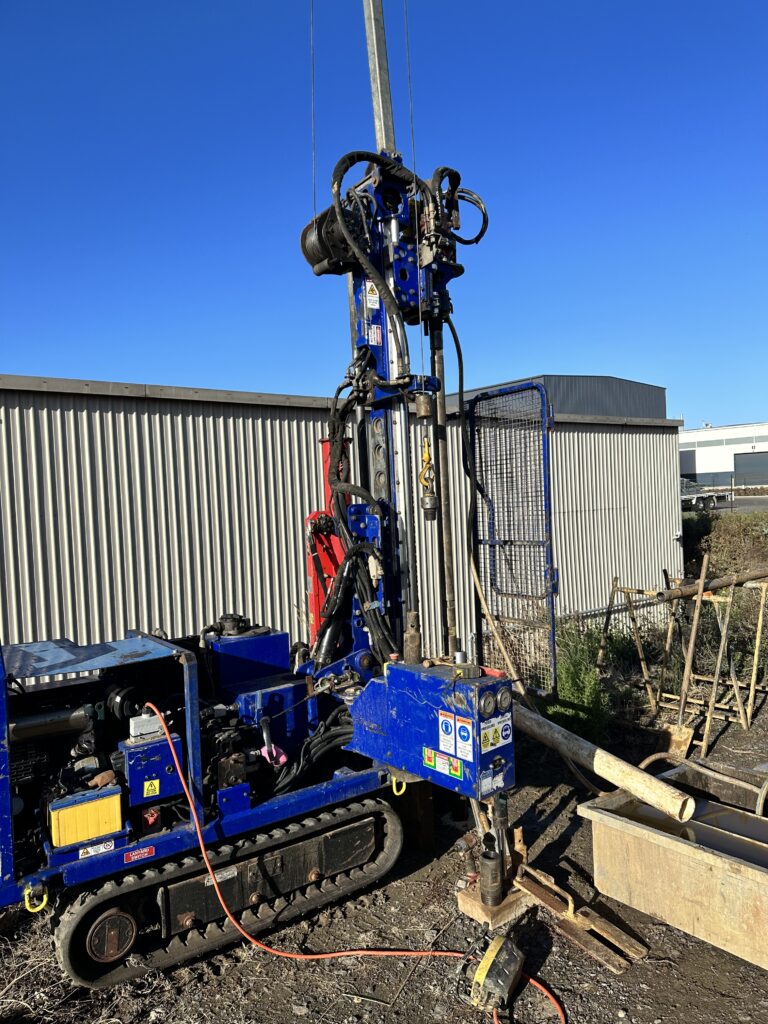
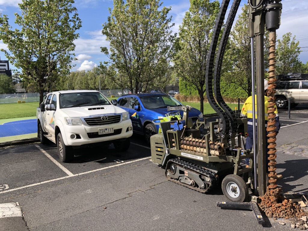
5. Efficient Stromwater Management Plan
An efficient stormwater management plan in geotechnical and structural engineering is a comprehensive strategy designed to effectively collect, control, and manage stormwater runoff from urban areas, industrial sites, or any location prone to heavy rainfall or flooding. This plan integrates geotechnical and structural engineering principles to mitigate potential risks and ensure the responsible handling of stormwater.
Here is a description of key components and considerations for an efficient stormwater management plan:
Site Assessment: The plan begins with a thorough geotechnical assessment of the site, including soil properties, permeability, topography, and groundwater conditions. This information informs the design of stormwater management infrastructure.
Design of Drainage Systems: Engineers design an integrated network of drainage systems, including stormwater sewers, culverts, channels, and retention basins. The design considers factors such as the expected volume and intensity of rainfall, local soil characteristics, and the flow paths of stormwater.
Sustainable Practices: An efficient plan emphasizes sustainable stormwater management practices, such as green infrastructure (e.g., permeable pavements, vegetated swales) that allow for natural infiltration, filtration, and storage of stormwater.
Detention and Retention: Structural engineering plays a role in designing detention and retention basins that temporarily store and slowly release stormwater. These structures help prevent downstream flooding and reduce the impact of peak flows.
Erosion and Sediment Control: Geotechnical measures, such as erosion control blankets and silt fences, are incorporated to minimize soil erosion and sediment transport from construction sites into stormwater systems.
Water Quality Considerations: The plan addresses water quality by implementing stormwater treatment measures such as sedimentation ponds, oil-water separators, and biofiltration systems to remove pollutants from runoff.
Floodplain Mapping: Geotechnical and structural engineers work together to map floodplains accurately and design flood control structures like levees and floodwalls to protect against inundation.
Hydraulic Modeling: Hydraulic modeling tools are used to simulate stormwater flow patterns and evaluate the effectiveness of drainage systems. This helps optimize the design and ensure that it meets regulatory requirements.
Sustainability and Resilience: The plan considers long-term sustainability and resilience by accounting for climate change projections and potential increases in storm intensity and frequency.
Maintenance and Monitoring: An efficient stormwater management plan includes provisions for regular maintenance and monitoring of stormwater infrastructure to ensure its continued functionality and compliance with regulations.
6. What is landslip risk management, and why is it important in geotechnical and structural engineering?
Landslip risk management involves assessing and mitigating the risks associated with landslides and slope failures in construction and engineering projects. It is crucial because landslides can compromise the safety and stability of structures, leading to significant economic and environmental consequences.
What factors contribute to landslip risks in geotechnical and structural engineering?
Landslip risks can be influenced by factors such as soil composition, slope steepness, rainfall patterns, geological conditions, construction activities, and changes in groundwater levels. Understanding these factors is essential for risk assessment.
How are landslip risks assessed in geotechnical and structural engineering projects?
Landslip risk assessments typically involve geotechnical investigations, slope stability analyses, and the use of geospatial data. These assessments help identify potential hazards and vulnerabilities in engineering projects.
What measures can be taken to mitigate landslip risks in construction and engineering projects?
Mitigation strategies may include slope stabilization techniques (e.g., retaining walls, soil nails), proper drainage design, geotechnical engineering controls, early warning systems, and adherence to best practices in foundation design.
Are there specific regulations or standards for landslip risk management in construction and engineering?
Yes, many regions have regulations and standards that require landslip risk assessments and mitigation plans for construction and engineering projects, particularly in areas prone to landslides.
Who is responsible for landslip risk management in construction and engineering projects?
Responsibility for landslip risk management typically falls on geotechnical engineers, structural engineers, project managers, and construction teams. Collaboration among these stakeholders is crucial for effective risk management.
What are some common signs of landslip risks in construction or engineering projects?
Signs may include ground movement, cracks in structures or foundations, bulging slopes, soil erosion, and surface water runoff issues. Identifying these signs early is essential for taking preventive measures.
How can climate change impact landslip risks in geotechnical and structural engineering?
Climate change can exacerbate landslip risks through increased rainfall intensity, altered precipitation patterns, and more frequent extreme weather events. Engineers must consider these changing conditions in their designs and risk assessments.
Is landslip risk management only relevant for projects in hilly or mountainous regions?
No, landslip risks can exist in various terrains, including urban areas with cut slopes, coastal regions with erosion-prone cliffs, and areas with weak or expansive soils. Landslip risk management is essential wherever slope stability is a concern.
What steps can be taken by individuals or organizations to proactively manage landslip risks in geotechnical and structural engineering projects?
Key steps include conducting thorough geotechnical investigations, monitoring ground conditions, implementing appropriate engineering controls, adhering to regulations, and staying informed about local geological hazards.
7. Land Capability Assessment for Unserviced Lots
Land Capability Assessment for Unserviced Lots in Geotechnical and Structural Engineering
Land capability assessment for unserviced lots is a critical process in geotechnical and structural engineering, designed to evaluate the suitability and limitations of undeveloped land parcels that lack essential infrastructure services such as water, sewage, and electricity. This assessment is crucial for informed decision-making in land development and construction projects. Here’s a comprehensive description of the process:
Preliminary Site Investigation:
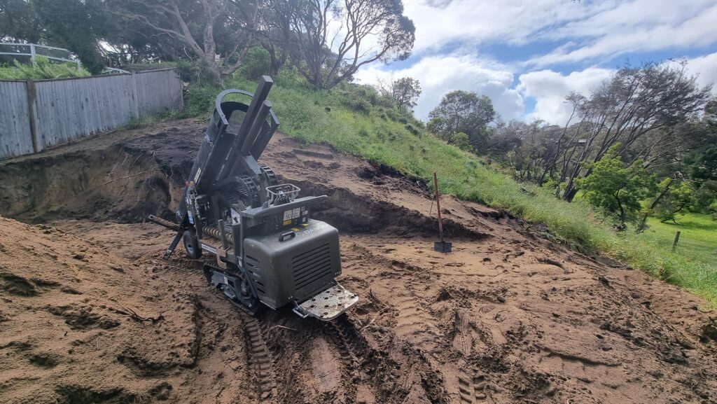
The assessment begins with a preliminary site investigation, where geotechnical engineers and environmental experts gather relevant data. This includes topographical surveys, soil and geology studies, hydrological information, and an understanding of local climate conditions.
Soil Analysis:
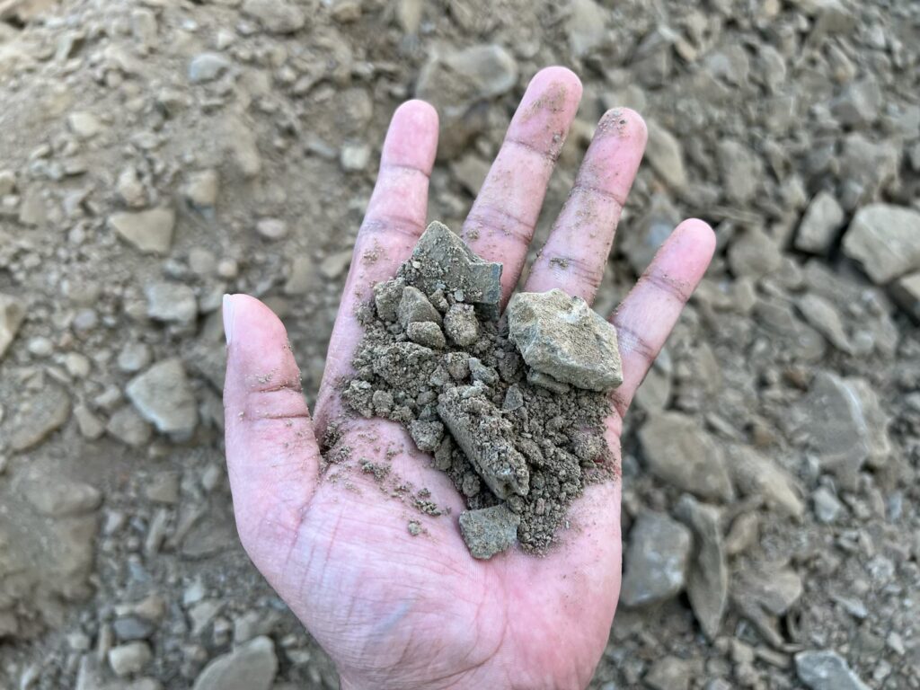
One of the primary focuses is on soil analysis. Geotechnical engineers examine soil composition, texture, compaction, bearing capacity, and permeability. This data helps determine the land’s ability to support structures and its susceptibility to erosion or landslides.
Geology Assessment:
Geologists assess the geological conditions of the site, looking for potential geological hazards such as fault lines, rock formations, or subsurface voids. Understanding the geological context is vital for foundation design and risk mitigation.
Slope Stability Analysis:
Engineers evaluate slope stability to identify any potential risks of landslides or slope failures. This analysis considers factors like slope angle, soil properties, and groundwater conditions to assess the land’s stability.
Hydrological Study:
The assessment includes a hydrological study to understand water flow patterns, runoff characteristics, and the potential for flooding or surface water management issues. This information is crucial for drainage system design.
Environmental Considerations:
Environmental experts assess the ecological impact of development on the unserviced lot. They evaluate potential habitat disruption, rare species presence, and any wetlands or water bodies that need protection.
Infrastructure Evaluation:
Geotechnical and structural engineers assess the feasibility of providing essential infrastructure services to the lot, such as access roads, water supply, sewage systems, and electrical connections. This evaluation helps determine the cost and feasibility of servicing the site.
Regulatory Compliance:
The assessment ensures compliance with local regulations and zoning ordinances. Engineers and environmental consultants work to identify any restrictions, permits required, or environmental impact assessments needed for development.
Risk Mitigation and Recommendations:
Based on the assessment findings, geotechnical and structural engineers provide recommendations for risk mitigation and land development. These may include foundation design options, erosion control measures, drainage solutions, or adjustments to the project’s scope.
Report and Documentation:
A comprehensive report is generated summarizing all findings, recommendations, and assessments. This document serves as a critical reference for developers, landowners, and regulatory authorities, guiding decision-making and permitting processes.
Land capability assessment for unserviced lots plays a pivotal role in responsible land development. It helps ensure that construction projects are not only feasible but also environmentally sustainable, safe, and compliant with local regulations. Through careful analysis and informed decision-making, it maximizes the potential of undeveloped land while minimizing risks and environmental impact.
OUR VALUABLE CLIENTS
×


